-> Maps
Statistics
Satellite/Aerial Photos
Pictures
Publications
WWW Links
General Information![]()
-> Maps![]()
Statistics![]()
Satellite/Aerial Photos![]()
Pictures![]()
Publications![]()
WWW Links![]()
Click images to open maps. Please note that these maps are in German laguage.
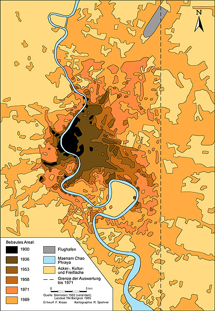 Expansion of Bangkok 1900 - 1989 |
 Bangkok and the Eastern Seaboard: Functional centres |
 Sinking land in Bangkok 1933-1990s |
 Marginal Settlements in Bangkok (Source: Sopon 1993) |