Bogotá Documentation
General Information
Maps
Statistics
Satellite/Aerial Photos
-> Pictures
Publications
WWW Links
Bogotá Pictures
Click images to enlarge. See bottom of page for descriptions.
Picture Descriptions
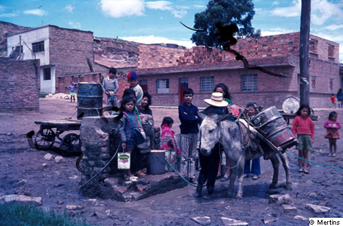
1: Consolidated informal (semilegal; "barrio pirata") underclass district, with partly insufficient infrastructure (public water tap).
© G. Mertins [back to picture]
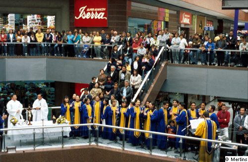
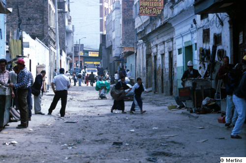
2: Multifunctional use of a shopping centre: mass on Sunday morning.
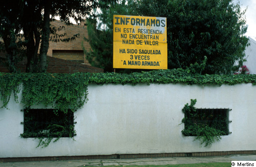
© G. Mertins [back to picture]
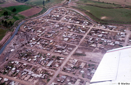
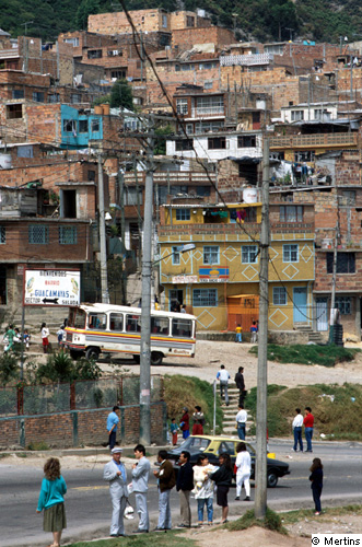
3: Semilegal urban underclass district ("barrio pirata") with planned groundplane and with space for the central district place.
© G. Mertins [back to picture]
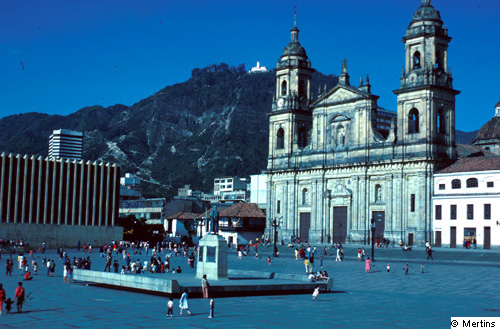
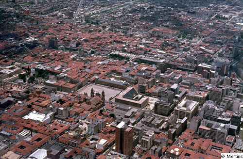
4: Plaza de BolĒvar (central square) with cathedral and Ministry of Justice (on the left, before destruction in November 1985), almost at the place of the city foundation in 1538 (persistence of location and functions!).
© G. Mertins [back to picture]
5: Plaza de BolĒvar with important public and religious buildings: main cathedral - Capitol (National Parliament) - City Council (in front of the cathedral) - Ministry of Justice.
© G. Mertins [back to picture]
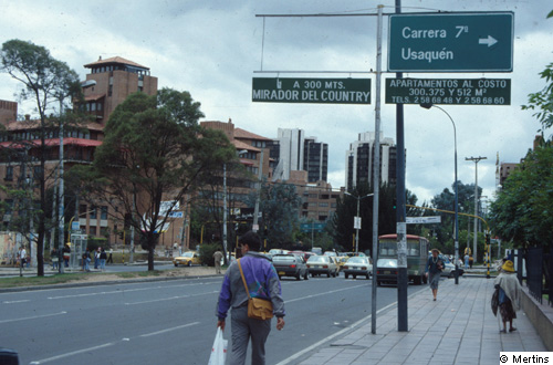
6: Avenida 15 / Avenida 127, in front of the Unicentro, the oldest shopping centre (1976): offers condominiums of 300, 375 and 512 m2 ("gated houses").
© G. Mertins [back to picture]
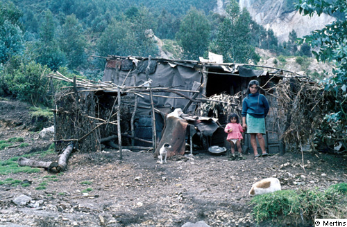
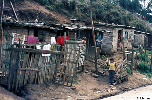
7: Hut within an invasion district in the higher parts of Bogotß, nearly 3000 m ("tierra frĒa").
© G. Mertins [back to picture]
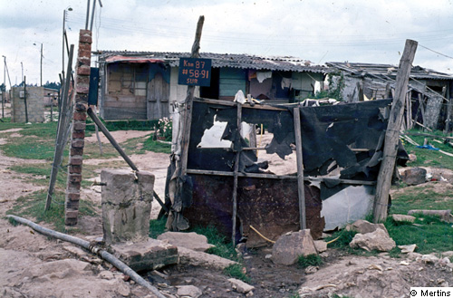
8: Informal (semilegal; "barrio pirata") underclass district with beginning legalization (street sign: kra. 87-58-91 SUR) in front of a restroom and a public water tap.
© G. Mertins [back to picture]
9: Formerly informal underclass district in an extreme hillside position; 10-12 years after foundation: nearly completely consolidated.
© G. Mertins [back to picture]
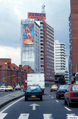
10: New CBD-formation, close to Avenida 72 (Chile) - Carrera 7; at the left: former (1950/1960) uperclass districts.
© G. Mertins [back to picture]
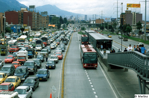
11: Autopista del Norte - Calle 100, view to the city centre: new public bus transport system.
© G. Mertins [back to picture]
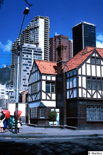
12: Former upperclass district (1930/1940) and modern highrise buildings (Centro Internacional; Carrera 7 - Calle 26 / Avenida 32).
© G. Mertins [back to picture]
13: Urban underclass district El Cartucho, mainly demolished in 2001/2002, 3-4 blocks west of Plaza BolĒvar.
© G. Mertins [back to picture]
14: House within an upperclass district, surrounded by a wall (Avenida 19 - Calle 105/106), with the notice: "In this house there are no objects of value. It has been robbed three times with armed force."
© G. Mertins [back to picture]
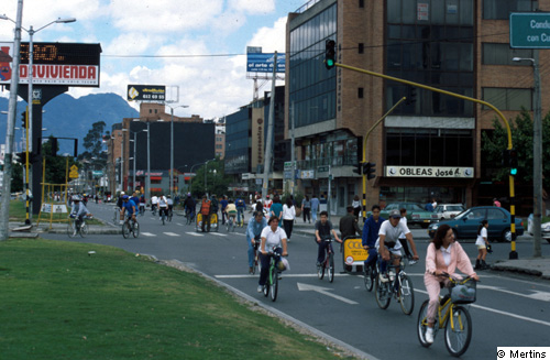
15: Closing of main roads on Sunday morning for walking, jogging, biking etc.; here: Avenida Pepe Sierra - Avenida 19.
© G. Mertins [back to picture]
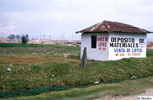
16: Selling of lots in an informal underclass district (semilegal; "barrio pirata") under construction; at the same time: deposit and selling of building materials.
© G. Mertins [back to picture]
17: Illegal underclass district ("barrio de invasi¾n) on the slopes of the Eastern Cordillera.
© G. Mertins [back to picture]
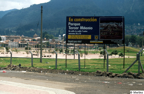
18: Type of re-development of parts of the old town: total demolition of the underclass district El Cartucho and "construction" of a public park.
© G. Mertins [back to picture]