São Paulo Documentation
General Information
Maps
Statistics
Satellite/Aerial Photos
-> Pictures
Publications
WWW Links
São Paulo Pictures
Click images to enlarge. See bottom of page for descriptions.
Picture Descriptions
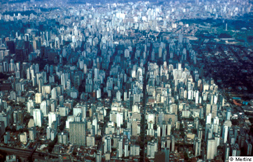
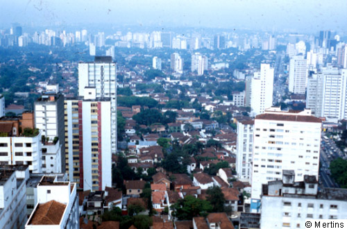
1: The "ocean" of high-rise buildings illustrates the size and concentration of the second largest Latin American agglomeration, and the fourth largest worldwide.
© G. Mertins, 2001 [back to picture]
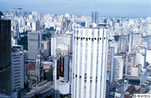
2: The concentration of high-rises in the city centre underlines the dominating position of SŃo Paulo.
© G. Mertins, 2001 [back to picture]
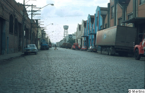
3: Industrial "lane" with factories and warehouses from the 30s of the 20th century; city district of Moça.
© G. Mertins, 2001 [back to picture]
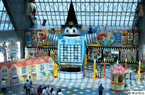
4: Since the 70s shopping centres (centros comerciales) have been part of the "supply standard", especially of the upper classes, in the Latin American metropolitan agglomerations; the first Latin American shopping centre was created in SŃo Paulo in 1996; here: "Shopping" El Dorado with a Disneyland zone (care centre for small children during shopping).
© G. Mertins, 2001 [back to picture]
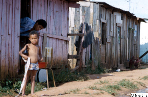
5: Informally and often illegally grown hut districts also characterize the marginal zones of the megacity of SŃo Paulo; however, they rarely accomodate direct immigrants but rather lower-class households that mostly have been driven out of their former "lodgings".
© G. Mertins, 2001 [back to picture]
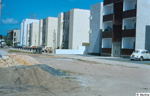
6: Giant subsidized housing districts (comprising up to 5,000/6,000 housing units) have been developed since the mid-sixties, financed by the Banco Nacional de HabitańŃo and its branches in the different cities, to somehow "cope" with the housing problem; however, mainly directed to households of the middle and lower middle classes; here: examples from Heliopolis in the SSE of the agglomeration.
© G. Mertins, 2001 [back to picture]
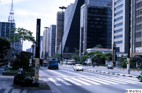
7: Rua Paulista: "the" banking street, not only of Brazil but of Latin America; clear document for SŃo Paulo's position as leading economic centre of Latin America. Former family mansions (today used as museums or for representation) indicate their predominant function until the 30s and 40s of the 20th century: living quarters of the upper class (after leaving the old district).
© G. Mertins, 2001 [back to picture]
8: High-rise apartment blocs advancing into the former upper-class district (Avenidas Lorena - Rebouńas); with large, leafy lots).
© G. Mertins, 2001 [back to picture]