Buenos Aires Documentation
General Information
Maps
Statistics
Satellite/Aerial Photos
-> Pictures
Publications
WWW Links
Buenos Aires Pictures
Click images to enlarge. See bottom of page for descriptions.
Picture Descriptions
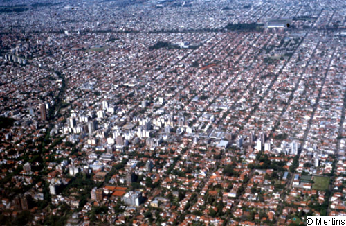
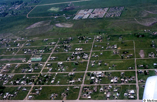
1: Typical chessboard pattern in the flat pampa: uninhibited area growth and extension of the 12.5 Mio. agglomeration.
© G. Mertins, 2001 [back to picture]
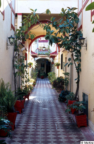
2: Elaborate reconstruction of former conventillos (receiving quarters for European immigrants of the late 19th and early 20th centuries, later degraded to slums) in the district of San Telmo.
© G. Mertins, 2001 [back to picture]
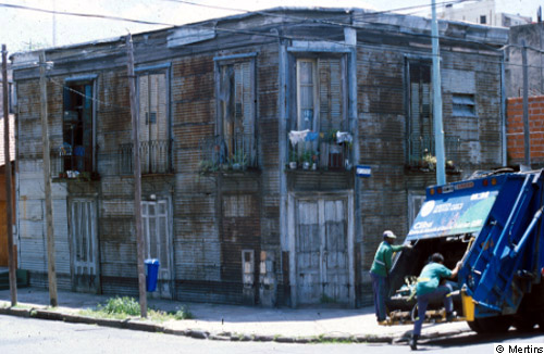
3: Inhabited conventillo, degraded to slums, city district of Boca.
© G. Mertins, 2001 [back to picture]
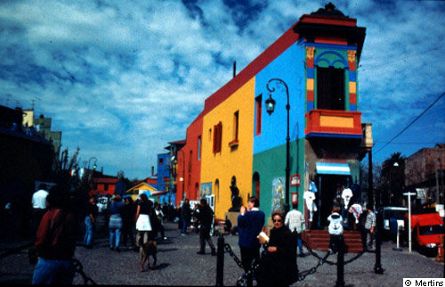
4: Renovation of facades in the district of Boca, formerly residential area of predominantly Italian immigrants, today a tourist attraction.
© G. Mertins, 2001 [back to picture]
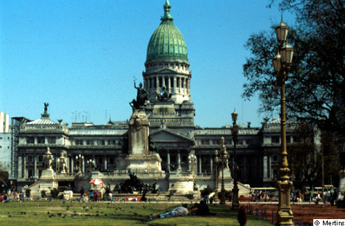
5: Congress (parliament building), in the style of the Washington Capitol.
© G. Mertins, 2001 [back to picture]
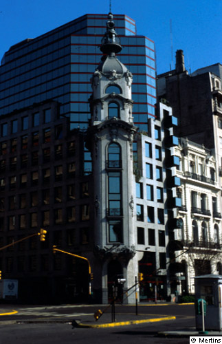
6: Downtown: post-modern administrative building with integrated old front (end of 19th century).
© G. Mertins, 2001 [back to picture]
7: Sub-urbanization process in the SW of the agglomeration (Ca±uelas); plots for high-standard family homes, partly gated communities.
© G. Mertins, 2001 [back to picture]
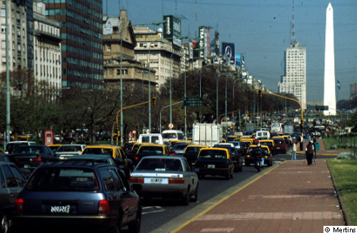
8: Avenida 9 de Julio, thoroughfare in the inner city, 140 m wide, completed in this form in 1949, with representative 8 to12-storey business and office buildings on both sides; obelisk (67 m high) erected 1936 to commemorate the 400th anniversary of the first, unsuccessful foundation of Buenos Aires.
© G. Mertins, 2001 [back to picture]