Dhaka Documentation
General Information
Maps
Statistics
Satellite/Aerial Photos
-> Pictures
Publications
WWW Links
Dhaka Pictures
Click images to enlarge. See bottom of page for descriptions.
Picture Descriptions
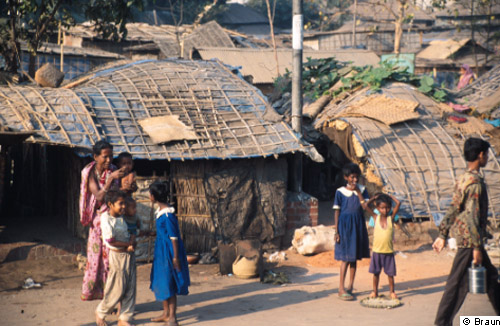
1: Typical hut settlement in Dhaka, predominantly inhabited by day labourers.
© B. Braun, 1999 [back to picture]
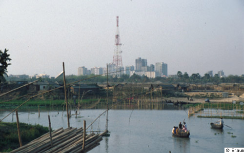
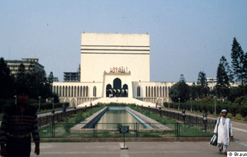
2: Contrasting the simple hut settlements on Banani Lake (foreground) with the prosperous northern municipal districts of Gulshan and Banani in the background; location Mohakali Avenue.
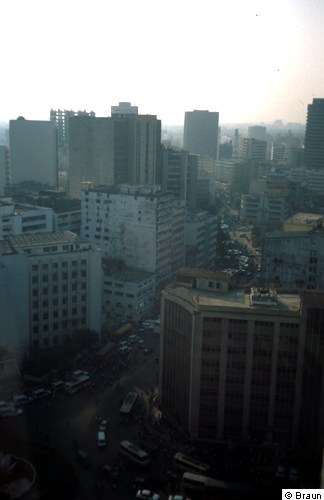
© B. Braun, 1999 [back to picture]
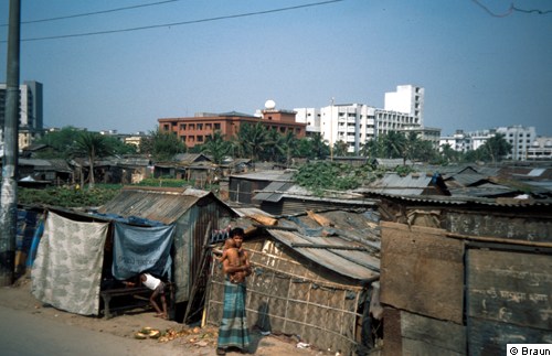
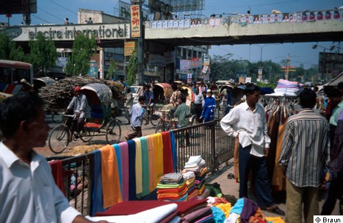
3: Agargoan bustee: one of the largest squatter settlements in Dhaka erected on government land (new government buildings in the background).
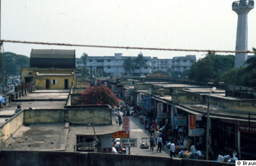
© B. Braun, 2002 [back to picture]
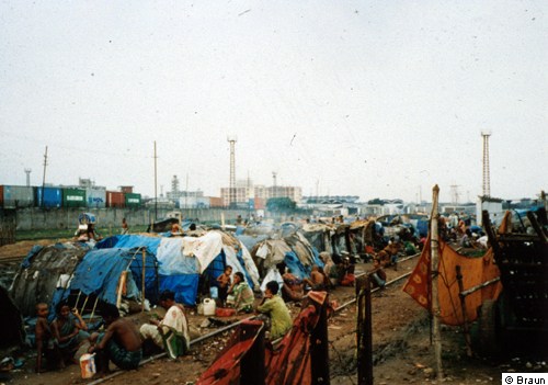
4: Extremely poor living conditions in a squatter settlement of rural migrants and flood refugees close to Dhaka's main station in the aftermath of the catastrophic flood in August/September 1998.
© B. Braun, 1999 [back to picture]
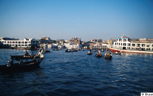
5: Passenger boats and smaller ships on Buriganga River: The app. 500 m wide river is still of outstanding importance for the transportation of people and goods in the Dhaka region.
© B. Braun, 1999 [back to picture]
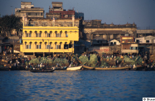
6: Old district of Dhaka: Trading and selling fruit and vegetables along the banks of Buriganga River.
© B. Braun, 1999 [back to picture]
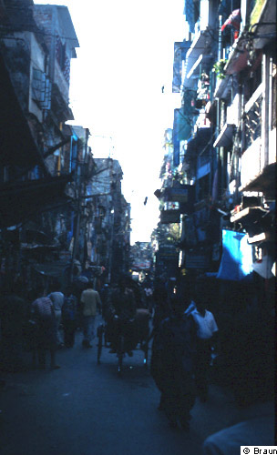
7: Lane in the narrow old district of Dhaka with the partially still existing bazaar structures.
© B. Braun, 1999 [back to picture]
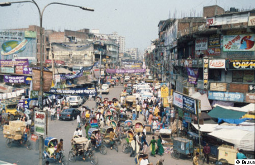
8: Typical street scene in Dhaka: As in the past, bicycle rickshaws are the main means of public transportation. Quite often, however, the traffic flow almost comes to a halt because bike rickshaws, moped rickshaws, busses, lorries, and - the still quite rare - private cars obstruct each other; southern end of Mirpur Road northwest of the old district.
© B. Braun, 1999 [back to picture]
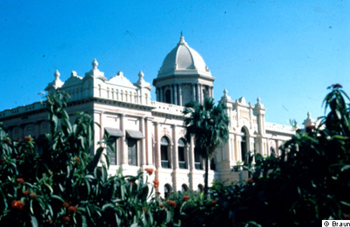
9: Ahsan Manzil, the palace of a Zamindar (feudal landlord) - built in 1872 - in the old district of Dhaka is one of the city's best preserved historic buildings. Today the complex houses a museum.
© B. Braun, 1999 [back to picture]
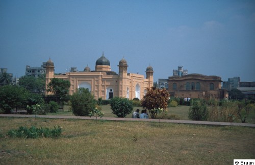
10: Lalbagh Fort, Old Dhaka: an expansive unfinished fort complex built in the late 17th century, when Dhaka was a provincial capital of the Mughal empire. The structure in the foreground is the Pari Bibi Mausoleum, the whole complex is enclosed by massive walls.
© B. Braun, 2002 [back to picture]
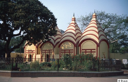
11: Dhakeswari Temple in Old Dhaka: the city's main Hindu temple, dating from the 12th century.
© B. Braun, 2002 [back to picture]
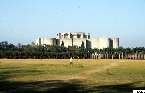
12: National Assembly building: the impressive building complex, designed by the renowned Jewish-American architect Louis Khan, was finished in 1982 after almost 20 years of planning and construction.
© B. Braun, 1999 [back to picture]
13: The national mosque (Baitum Mokarram Mosque) west of the modern central business district of Motijheel is the biggest mosque of Dhaka and an important centre for the city's predominantly Islamic population.
© B. Braun, 1999 [back to picture]
14: Modern high-rise buildings in Dhaka's central business district of Motijheel.
© B. Braun, 1999 [back to picture]
15: Street scene in Motijheel: the pavement is crowded by pedestrians and the displays of small traders.
© B. Braun, 2002 [back to picture]
16: New Market: a modern shopping centre, already completed in the 60s, for the consumer needs of the middle and upper classes northwest of the old district of Dhaka.
© B. Braun, 1999 [back to picture]
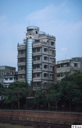
17: New apartment buildings for the upper middle class in the western fringe area of the inner city.
© B. Braun, 2002 [back to picture]
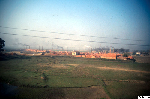
18: Brickyards constitute a typical commercial form of land use in the direct vicinity of Dhaka. They produce building materials for the rapid expansion of the city, but also contribute considerably to air pollution; northwestern border of the city.
© B. Braun, 1999 [back to picture]
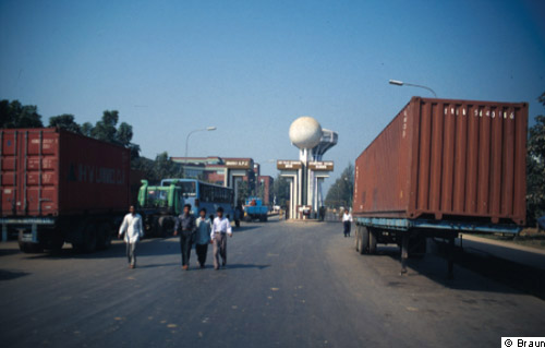
19: Dhaka Export Processing Zone (about 35 km northwest of Dhaka city centre and 25 km west of the airport): Since the 1980s one has tried to attract foreign enterprises through infrastructural offers and investment incentives in Export Processing Zones, however, so far with only limited success in comparison to other south and southeast Asian countries.
© B. Braun, 1999 [back to picture]