Lima Documentation
General Information
Maps
Statistics
Satellite/Aerial Photos
-> Pictures
Publications
WWW Links
Lima Pictures
Click images to enlarge. See bottom of page for descriptions.
Picture Descriptions
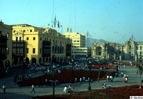
1: Plaza de Armas, the "foundation square" of Lima (1535); in the background Pizarro Palace, until today presidential palace, but completely reconstructed in neo-classical style. On the left the newly created municipal administration, built in 1944 in modern colonial style, and in the centre the square, completely reshaped in the years 1996/97.
© G. Mertins, 2001 [back to picture]
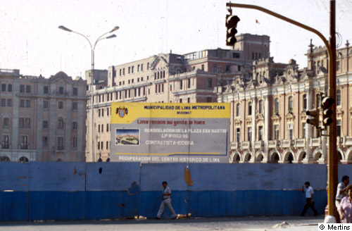
2: The renconstruction of the old district started rather late in Lima due to political disorders and lack of finances; here: Plaza San Martin, the true centre of Lima, about 500 m southwest of Plaza de Armas.
© G. Mertins, 2001 [back to picture]
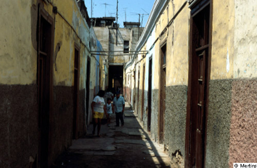
3: Callejones ("lanes"): working class quarters from the late 19th century, mostly windowless one-room flats, size 10-12 m▓, with common infrastructral facilities; later degraded to slums; about 300 m east of the presidential palace (see picture1).
© G. Mertins, 2001 [back to picture]
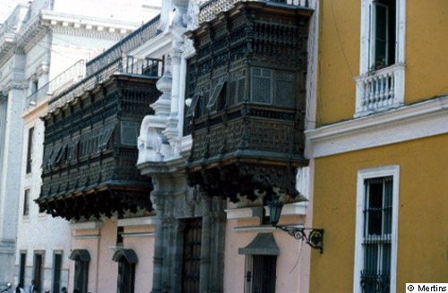
4: Torre Tagle Palace with its wood-carved balconies is one of the treasures of Spanish colonial architecture; today it houses departments of the foreign office.
© G. Mertins, 2001 [back to picture]
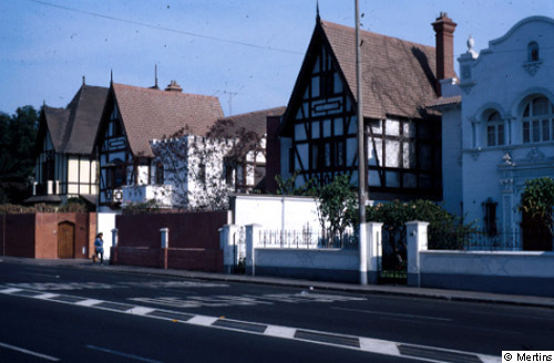
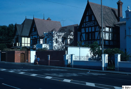
5: Upper-class district from the 30s and 40s of the 20th century; Calle Benavides/Miraflores.
© G. Mertins, 2001 [back to picture]
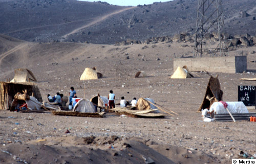
6: Initial phase of the formation of an illegal marginal district (barriada) in the coastal desert of Lima, about 25 km south of the city centre.
© G. Mertins, 2001 [back to picture]
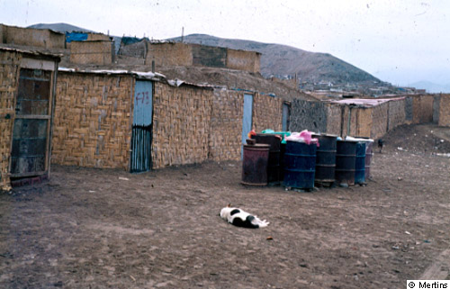
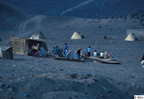
7: "Grown" barriada, about 20 km south of the city centre; the huts still consist of mats, some have tin doors; the consolidation phase has not yet started. Water supply is by tank-lorries; the water is kept in old casks (formation of disease-inducing germs!).
© G. Mertins, 2001 [back to picture]
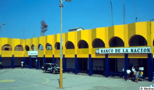
8: Central square with city hall, banks, etc. of Villa El Salvador, probably the best known barriada of Lima, about 18 km southeast of the city centre; created in 1971 through a government measure to relocate 25,000-30,000 persons from an illegal marginal district, with an initial allocation of the plots only; in the meantime grown to about 350,000 inhabitants who have moved there with mostly illegal land annexation.
© G. Mertins, 2001 [back to picture]
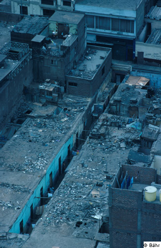
9: Until today, poorer population classes live in the historic district - with the exception of the major squares (Plaza de Armas, Plaza San MartĒn) and the few business streets. As a rule, the various street blocks are completely built up. Frequently one finds one-room lodgings along cul-de-sacs. These socalled callejones were partly built in the late 19th century already; they served as first dwellings for new immigrants.
© J. Bõhr [back to picture]
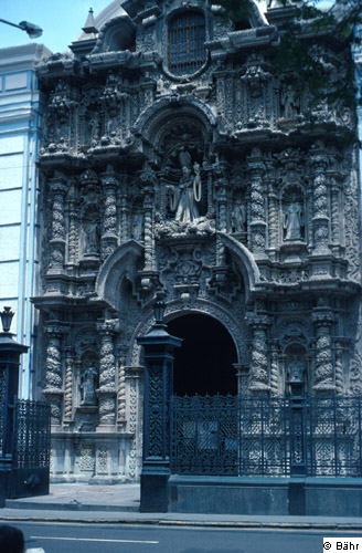
10: Although one of the oldest towns of South America and already founded in 1535 by Pizarro, Lima has not many colonial buildings. The largest part of the town had been destroyed by severe earthquakes in 1687 and 1746. The church San AgustĒn in the churrigueresk style dates back to the late 18th century.
© J. Bõhr [back to picture]
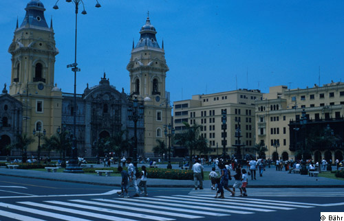
11: Still today, the plaza, centre of the colonial Spanish town, is characterized by cathedral and administrative buildings. The present-day church was built in the second half of the 18th century; all the other buildings surrounding the plaza, such as the town hall opposite the cathedral, are much younger. They were built in the 1920s to 1940s in the colonial style, often with wooden balconies.
© J. Bõhr [back to picture]
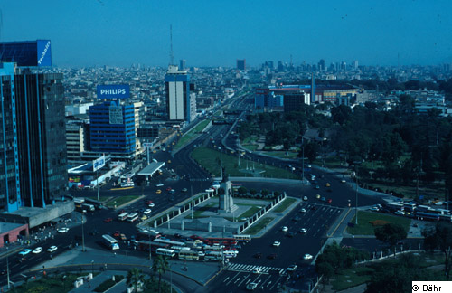
12: Broad streets - here the Paseo de la Rep·blica - connect the historic district with the southern suburbs. In the background are the high-rise buildings of Miraflores. Miraflores today is not only the favourite residential area of the higher social classes but it performs also many higher-ranking city functions.
© J. Bõhr [back to picture]
13: Since the 1920s the central city districts have increasingly been left by the upper classes. San Isidro and Miraflores, situated along Ave. Arequipa between historic district and seafront, have developed into preferred residential areas.
© J. Bõhr [back to picture]
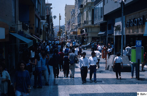
14: For some time now, higher-ranking central functions have left the historic district. The former main business street Jir¾n de la Uni¾n linking the two historic city squares (Plaza de Armas, Plaza MartĒn) appeals with its offers to tourists on the one hand and to middle and lower income groups on the other.
© J. Bõhr [back to picture]
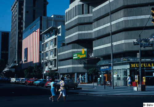
15: Today, high-ranking shops and service facilities can predominantly be found in the smart residential suburb of Miraflores, which by that has changed in terms of building substance and is partly characterized by high-rise buildings.
© J. Bõhr [back to picture]
16: Since the 1920s when the first barriada came into being (1924), urban growth manifests itself in the creation of hut districts (barriadas), which are called pueblos j¾venes (young districts) in Peru. As a rule, they originate in land occupations; the first makeshift dwellings are frequently made of straw mats. These land occupations were facilitated by state-owned areas which, however, could not be used owing to the desert climate.
© J. Bõhr [back to picture]
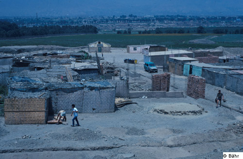
17: Not only in the south of the city (picture 16) but also in the north great areas are covered by barriadas. Once the legal situation of the settlers is secured a consolidation process starts by replacing the makeshift huts with stone houses.
© J. Bõhr [back to picture]
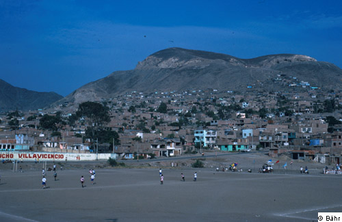
18: Villa Maria de Triunfo is a barriada, more or less consolidated in terms of buildings. The great majority of houses is built of stone. Superstructures and extensions are used in many cases to accommodate new migrants as sub-tenants. It is estimated that about 40% of the 7.5 million inhabitants of Lima live in barriadas at present.
© J. Bõhr [back to picture]
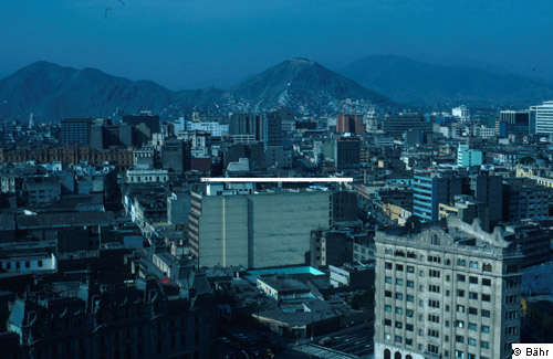
19: The view from South to North across the historic district shows a very heterogeneous building substance: only a few high-rises, the city functions are limited to some streets only, many of the older one- and two-storey buildings are living quarters of poorer population groups. Along the slopes in the background, already beyond RĒo Rimac, older hut regions that have been consolidated for a long time (barriadas) can be recognized.
© J. Bõhr [back to picture]